Southeast 2023
Native American History and Culture, The Spell of the Sensuous and Becoming Animal, Black History and Culture, The Civil War
Roadtrippers Map version 11/13/2022
***********************************************
Use Aaron Carapella's Tribal Nations Maps to make note of First Nations reservations and the Tribal Nations Ancestral Lands you are on everywhere you go. Lives Reclaimed Through Maps Supreme Court ruling in late June is a recent example of a growing divide between the Supreme Court and Congress over federal Indian law. The ruling highlights the relevance of one man’s decades-long cartography effort to document thousands of Native American Tribes.
Which Indigenous lands are you on? This map will show you. October 10, 2022 NPR.
Native Land Digital Map
Native Land Digital Territory Acknowledgement
US Native American Tribes by Regions Ethnographers commonly classify the native peoples of the United States and Canada into ten geographical culture regions with shared cultural traits. These cultural regions are broadly based upon the locations of indigenous peoples of the Americas from the time of early European and African contact beginning in the late 15th century. When indigenous peoples have been forcibly removed by nation-states, they retain their original geographic classification. Some groups span multiple cultural regions. The following list groups native american indian tribes by region of origin, followed by the current tribal names and/or reservation locations. Tribes are ethnically, culturally and linguistically diverse. There are 562 federally recognized Indian tribes, bands, nations, pueblos, rancherias, communities and Native villages in the United States.
Society of Architectural Historians (Gulf Coast Tribes)
"...as you explore SAH Archipedia you will also find landscapes, infrastructure, monuments, artwork, and more. This cross-section of the country demonstrates the richness and diversity of architecture and building practice across many centuries, from mud brick to steel, from ancient cliff dwellings to contemporary office towers—a history that unfolds in individual building entries and thematic essays written by leading architectural historians who survey and explain styles and typologies, materials and techniques, and social and political contexts, from local to state to national levels."
TRIBAL MAP PDF SPREADSHEET - LIST OF NATIVE AMERICAN TRIBES WITH THEIR INDIGENOUS/GIVEN NAMES
| tribal_nations_maps_list_of_namesbibliography___pronounciation_guide.xlsx |
***********************************************
Physical Regions
Pueblo Culture
Okla Homma
Comancheria
Apacheria SEE map, below.
Big Bend National Park
The Civil War
Black Culture
Okla Homma
Comancheria
Apacheria SEE map, below.
Big Bend National Park
The Civil War
Black Culture
US Native American Tribes by Regions Ethnographers commonly classify the native peoples of the United States and Canada into ten geographical culture regions with shared cultural traits. These cultural regions are broadly based upon the locations of indigenous peoples of the Americas from the time of early European and African contact beginning in the late 15th century. When indigenous peoples have been forcibly removed by nation-states, they retain their original geographic classification. Some groups span multiple cultural regions. The following list groups native american indian tribes by region of origin, followed by the current tribal names and/or reservation locations. Tribes are ethnically, culturally and linguistically diverse. There are 562 federally recognized Indian tribes, bands, nations, pueblos, rancherias, communities and Native villages in the United States.

May 28, 1830 CE: Indian Removal Act Congress passed the Indian Removal Act, beginning the forced relocation of thousands of Native Americans in what became known as the Trail of Tears.
Experiential & Spiritual
Foodways and Natural Medicines & Food Sovereignty
Water is Life
Education and Languages
Art, Music, Dance, Literature, Poetry, Film, Storytellers and Warriors
History
Current Issues
Water is Life
Education and Languages
Art, Music, Dance, Literature, Poetry, Film, Storytellers and Warriors
History
Current Issues
Deep Diving Terms and Concepts
FIMO: Decolonization; Deep Green Resistance; IPH chapters: sacred corn food, the culture of conquest, cult of the covenant, bloody footprints, birth of a nation, the last of the Mohicans and andrew jackson's white republic, sea to shining sea, Indian Country and Buffalo, US TRIUMPHALISM AND PEACETIME COLONIALISM, GHOST DANCE PROPHECY, THE DOCTRINE OF DISCOVERY,THE FUTURE OF THE UNITED STATES . foraging foodwaysa agriculture art music dance language education TSLGBTQ water is life spell of the sensuous becoming animal earth-based spirituality cultural cosmologies ethnobotany
May 28, 1830 CE: Indian Removal Act Trail of Tears. Experiential & Spiritual
Bibliography
Abram, David. Becoming Animal: an Earthly Cosmology. Pantheon Books, 2010. (BA)
Abram, David. The Spell of the Sensuous: Perception and Language in a More-than-Human World. Vintage Books, a
Division of Penguin Random House LLC, 2017. Dunbar-Ortiz, Roxanne.
An Indigenous Peoples' History of the United States (REVISIONING HISTORY) (2104). (IPH)
Foote, Shelby. The Civil War: A Narrative - 3 Volume Set. (1986). (CWN)
Harjo, Joy, and Gloria Bird. (eds. & contrs.) Reinventing the Enemy's Language: Contemporary
Native Women's Writing of North America. (1997). (REL)
Gwynne, S.C. Empire of the Summer Moon: Quanah Parker and the Rise and Fall of the Comanches, the Most Powerful Indian Tribe in American History (2010 ). (ESM)
Library of Congress, Wagner, Margaret E. (et al.) The Library of Congress Illustrated Timeline of the Civil War
(CWT)
Thrapp, Dan L.. The Conquest of Apacheria (1975). Not vetted. (TCA)
Waziyatawin and Yellow Bird, Michael. For Indigenous Minds Only - A Decolonization Handbook. (FIMO)
***********************************************
Itinerary
Stacey's Roadtrippers Map Version 10/29/22
26 days 19 days to Jackson
- Cheyenne to Great Sand Dunes - 322 mi., 5.5 hrs., (1 day) ($0 camping) Great Sand Dunes National Park SEE Camping
- to Pueblo Jemez - 292 mi., 4 hrs. (2 days) ($175 camping) Vista Linda Campground
- to Albuquerque NM Indian Pueblo Cultural Center - 45 mi., 1 hr. (2 days) Camping
- -+
- to Palo Duro Canyon State Park - 305 mi., 5 hrs. (3 days) Camping
- to Washita Battlefield NHS - 160 mi., 3 hrs. Camping Washita Battlefield offers cell phone audio tours along the battlefield trail. Numbered posts along the trail indicate when to dial up the tour. Although the entire trail is 1 ½ miles long, it is not necessary to walk the trail to listen to the audio tour. Listen at anytime and anywhere. There are 15 stops.The audio tour is free. Call (580) 354-7453 and follow the prompts.
- to Oklahoma City First Americans Museum (FAM) - 280 mi., 4.5 hrs. (2 days) SEE FAM Routes Map, below. Camping ONE PLACE, MANY NATIONS In one place, visitors experience the collective histories of 39 distinctive First American Nations in Oklahoma today. First Americans Museum shares the cultural diversity, history, and contributions of the First Americans.
- to Lawton OK Comanche National Museum and Cultural Center, Comanche Nation Website - 87 mi., 1.5 hrs. (2 days) Camping
- to Big Bend National Park NPS - 567 mi., 9 hrs. (5 days) Camping
- to Padre Island National Seashore - 550 mi., 9 hrs. (3 days) Camping
- to Lake Charles LA - 396 mi., 7 hrs. (1 day) Camping
- to Jackson - 190 mi., 3 hrs. (7 days) Camping, gen'l Timberlake Campground
***********************************************
Pueblo Culture
Comancheria
Meet the Geronimos: Descendants Talk About Living With the Legacy FRANCES MADESON. Navajo Times SEP 13, 2018.
5. Lawton OK - 1 day travel and 2 day layover Avg. temps. hi 55, low 32
Comancheria
Empire of the Summer Moon - Quanah Parker and the Rise and Fall of the Comanches, the Most Powerful Indian
Tribe in American History, by S.C. Gwynne
https://video.search.yahoo.com/search/video?fr=mcafee&ei=UTF-8&p=comancheria&type=E210US91088G0#action=view&id=2&vid=a3d3c4fc204e57c9eca95551d279fda1
Comanches and Horses NPS
El Camino Real de los Tejas
https://www.nps.gov/elca/
https://www.nps.gov/elca/
El Camino Real de Tierra Adentro National Historic Trail
The Comanche and the Horse PBS
Comanche Indian Reservation Texas Historical Assoc.
Pueblo Culture
OKLA HOMMA from two Choctaw words “Okla” and “Homma” meaning Red People.
First Americans Museum (FAM) OK City SEE FAM Routes Map, below.
FAM Routes Map
Only a few tribal Nations were indigenous to what is now the State of Oklahoma. All others were removed from homelands across the contiguous U.S. to Indian Territory. In 1907 Oklahoma became the 46th state to enter the union.
Only a few tribal Nations were indigenous to what is now the State of Oklahoma. All others were removed from homelands across the contiguous U.S. to Indian Territory. In 1907 Oklahoma became the 46th state to enter the union.
Texas
Comancheria

Comanche Nation Website
We are the Comanche Nation and in our native language “Nʉmʉnʉʉ” (NUH-MUH-NUH) which means, “The People”. We are known as “Lords of the Plains” and were once a part of the Shoshone Tribe. In the late 1600’s and early 1700’s we moved off from our Shoshone kinsmen onto the northern Plains and then southerly in search a new homeland. We Migrated across the Plains, through Wyoming, Nebraska, Colorado, Kansas, New Mexico, Texas and Oklahoma. We ultimately settled here in Southwest Oklahoma. The horse was a key element in Comanche culture. The people mastered their skills on horseback and gained a tremendous advantage in times of war.
We are the Comanche Nation and in our native language “Nʉmʉnʉʉ” (NUH-MUH-NUH) which means, “The People”. We are known as “Lords of the Plains” and were once a part of the Shoshone Tribe. In the late 1600’s and early 1700’s we moved off from our Shoshone kinsmen onto the northern Plains and then southerly in search a new homeland. We Migrated across the Plains, through Wyoming, Nebraska, Colorado, Kansas, New Mexico, Texas and Oklahoma. We ultimately settled here in Southwest Oklahoma. The horse was a key element in Comanche culture. The people mastered their skills on horseback and gained a tremendous advantage in times of war.
Wyoming, ESM p. 27.
Nʉmʉnʉʉ Sookobitʉ (Comanche) (territories) Native Digital
Comanche Nation Website
Empire of the Summer Moon - Quanah Parker and the Rise and Fall of the Comanches, the Most Powerful Indian Tribe in American History , by S.C. Gwynne Empire of the Summer Moon spans two astonishing stories. The first traces the rise and fall of the Comanches, the most powerful Indian tribe in American history. The second entails one of the most remarkable narratives ever to come out of the Old West: the epic saga of the pioneer woman Cynthia Ann Parker and her mixed-blood son Quanah, who became the last and greatest chief of the Comanches. The war with the Comanches lasted four decades, in effect holding up the development of the new American nation. Gwynne’s exhilarating account delivers a sweeping narrative that encompasses Spanish colonialism, the Civil War, the destruction of the buffalo herds, and the arrival of the railroads, and the amazing story of Cynthia Ann Parker and her son Quanah.
Comanche Indian Reservation Texas Historical Assoc.
Apacheria

APACHERÍA
The term Apachería is used to designate the area inhabited by the Apache Indians. Since there has been a written record, this has been in a region extending from north of the Arkansas River into the northern states of Mexico and from Central Texas to Central Arizona.
The term Apachería is used to designate the area inhabited by the Apache Indians. Since there has been a written record, this has been in a region extending from north of the Arkansas River into the northern states of Mexico and from Central Texas to Central Arizona.
Apache leaders - Cochise, Victorio, Loco, Mangus, Nachez, Nana, Geronimo
Geronimo (1829-1909) was an Apache leader and medicine man best known for his fearlessness in resisting anyone–Mexican or American—who attempted to remove his people from their tribal lands.
Geronimo (1829-1909) was an Apache leader and medicine man best known for his fearlessness in resisting anyone–Mexican or American—who attempted to remove his people from their tribal lands.
Yavapai-Apache Website Camp Verde AZ
Meet the Geronimos: Descendants Talk About Living With the Legacy FRANCES MADESON. Navajo Times SEP 13, 2018. Their Apache ancestors were chased, hunted and herded into history. Shaped by decades of war, Geronimo, Cochise, Victorio, Lozen and Mangas Coloradas (and those they ran with) cultivated a genius for survival so their descendants could live on.
Dances
https://www.facebook.com/watch?v=840867063602981
https://wyoming.pbslearningmedia.org/resource/natam.arts.dance.abapache/native-american-culture-about-apache-dances/
The Spell of the Sensuous and Becoming Animal
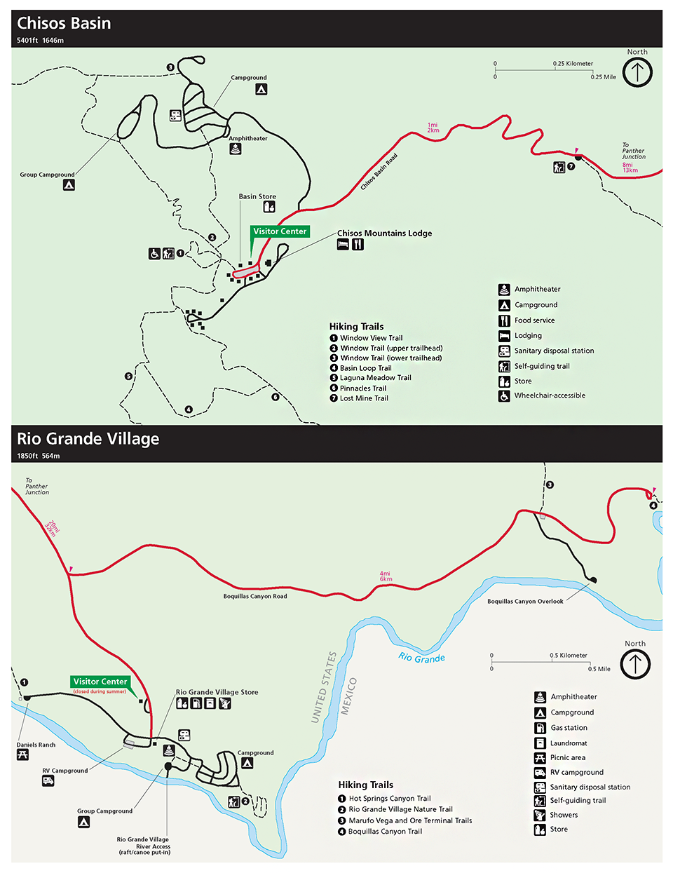
| big-bend-paisano-visitor-guide-2022-2023.pdf |
Avg. Temp. Jan./Feb. - 65 to 74 deg. day, 45-50 deg. night
Rio Grande Village RV Park (full hookups)
The Stars
Big Bend National Park, straddling the Texas-Mexico border in the heart of the Chihuahuan Desert, sits far from the region’s biggest cities and towns—and boasts the least amount of light pollution of any national park in the lower 48 states. In 2012, the International Dark-Sky Association named Big Bend an International Dark Sky Park. In doing so, it shouted out the myriad ways Big Bend works to protect its night skies—through shielding LED lights, cutting power consumption and installing motion sensors and timers so that lighting turns on only when necessary. These days, the park works to help visitors understand and appreciate that astral allure through star parties, moonlight walks and other interpretive events that show off constellations, planets and even the Milky Way.
Big Bend National Park, straddling the Texas-Mexico border in the heart of the Chihuahuan Desert, sits far from the region’s biggest cities and towns—and boasts the least amount of light pollution of any national park in the lower 48 states. In 2012, the International Dark-Sky Association named Big Bend an International Dark Sky Park. In doing so, it shouted out the myriad ways Big Bend works to protect its night skies—through shielding LED lights, cutting power consumption and installing motion sensors and timers so that lighting turns on only when necessary. These days, the park works to help visitors understand and appreciate that astral allure through star parties, moonlight walks and other interpretive events that show off constellations, planets and even the Milky Way.
The Civil War
American Battlefields Trust
Appomatox Courthouse NPS
Guide to Civil War Battlefields in Mississippi
Civil War Battlefields in Texas (NPS)
The Ten Bloodiest Battles of the Civil War - SEE graphic, below.
American Battlefields Trust
Appomatox Courthouse NPS
Guide to Civil War Battlefields in Mississippi
Civil War Battlefields in Texas (NPS)
The Ten Bloodiest Battles of the Civil War - SEE graphic, below.
Civil War Meridian MS February 14-20, 1864
Battle of Shiloh April 6 to April 7, 1862 Shiloh Church in southwestern Tennessee
The Mississippi Blues Trail Revisited - Spotify Podcast
The Mississippi Blues Trail//Cleveland, MS - The Wandering Chronicles Podcast (Spotify)
The Mississippi Blues Trail//Cleveland, MS - The Wandering Chronicles Podcast (Spotify)
Jackson
Timberlake Campground
| timberlakebrochure.pdf |
First Nations
Harjo, Joy, and Gloria Bird. (eds. & contrs.) Reinventing the Enemy's Language: Contemporary Native Women's
Writing of North America. W.W. Norton & Co., 1997.
This anthology celebrates the experience of Native American women and is at once an important contribution to our literature and an historical document. It is the most comprehensive anthology of its kind to collect poetry, fiction, prayer, and memoir from Native American women. Over eighty writers are represented from nearly fifty nations, including such nationally known writers as Louise Erdrich, Linda Hogan, Leslie Marmon Silko, Lee Maracle, Janet Campbell Hale, and Luci Tapahonso; others ― Wilma Mankiller, Winona LaDuke, and Bea Medicine ― who are known primarily for their contributions to tribal communities.
Use Aaron Carapella's Tribal Nations Maps to make note of First Nations reservations and the Tribal Nations Ancestral Lands you are on everywhere you go.
Nʉmʉnʉʉ Sookobitʉ (Comanche) (territories) Native Digital
Comanche Nation Website
Empire of the Summer Moon - Quanah Parker and the Rise and Fall of the Comanches, the Most Powerful Indian Tribe in American History , by S.C. Gwynne Empire of the Summer Moon spans two astonishing stories. The first traces the rise and fall of the Comanches, the most powerful Indian tribe in American history. The second entails one of the most remarkable narratives ever to come out of the Old West: the epic saga of the pioneer woman Cynthia Ann Parker and her mixed-blood son Quanah, who became the last and greatest chief of the Comanches. The war with the Comanches lasted four decades, in effect holding up the development of the new American nation. Gwynne’s exhilarating account delivers a sweeping narrative that encompasses Spanish colonialism, the Civil War, the destruction of the buffalo herds, and the arrival of the railroads, and the amazing story of Cynthia Ann Parker and her son Quanah.
Comanche Indian Reservation Texas Historical Assoc.
Comanche Nation Website
Empire of the Summer Moon - Quanah Parker and the Rise and Fall of the Comanches, the Most Powerful Indian Tribe in American History , by S.C. Gwynne Empire of the Summer Moon spans two astonishing stories. The first traces the rise and fall of the Comanches, the most powerful Indian tribe in American history. The second entails one of the most remarkable narratives ever to come out of the Old West: the epic saga of the pioneer woman Cynthia Ann Parker and her mixed-blood son Quanah, who became the last and greatest chief of the Comanches. The war with the Comanches lasted four decades, in effect holding up the development of the new American nation. Gwynne’s exhilarating account delivers a sweeping narrative that encompasses Spanish colonialism, the Civil War, the destruction of the buffalo herds, and the arrival of the railroads, and the amazing story of Cynthia Ann Parker and her son Quanah.
Comanche Indian Reservation Texas Historical Assoc.
(RD-O) An Indigenous Peoples' History of the United States (REVISIONING HISTORY) by Roxanne Dunbar-Ortiz. (2104). ((to Howard Adams (1921–2001) Vine Deloria Jr. (1933–2005) Jack Forbes (1934–2011)). "Today in the United States, there are more than 500 federally recognized Indigenous nations comprising nearly three million people, descendants of the 15 million Native people who once inhabited this land. The centuries-long genocidal program of the US settler-colonial regimen has largely been omitted from history. Dunbar-Ortiz adroitly challenges the founding myth of the United States and shows how policy against the Indigenous peoples was colonialist and designed to seize the territories of the original inhabitants, displacing or eliminating them. And as Dunbar-Ortiz reveals, this policy was praised in popular culture, through writers like James Fenimore Cooper and Walt Whitman, and in the highest offices of government and the military. Spanning more than 400 years, this classic bottom-up peoples' history radically reframes US history and explodes the silences that have haunted our national narrative."
The Spell of the Sensuous
The Storytellers
Water is Life
Arts & Music

FAM Routes Map
Only a few tribal Nations were indigenous to what is now the State of Oklahoma. All others were removed from homelands across the contiguous U.S. to Indian Territory. In 1907 Oklahoma became the 46th state to enter the union. The state’s name comes from two Choctaw words “Okla” and “Homma” meaning Red People.
Only a few tribal Nations were indigenous to what is now the State of Oklahoma. All others were removed from homelands across the contiguous U.S. to Indian Territory. In 1907 Oklahoma became the 46th state to enter the union. The state’s name comes from two Choctaw words “Okla” and “Homma” meaning Red People.


Big Bend Paisano Visitor Guide
Bibliography
(IPH) An Indigenous Peoples' History of the United States (REVISIONING HISTORY)
by Roxanne Dunbar-Ortiz. (2104).
(CWN) The Civil War: A Narrative - 3 Volume Set, November 12, 1986 by Shelby Foote (Author)
(REL) Harjo, Joy, and Gloria Bird. (eds. & contrs.) Reinventing the Enemy's Language: Contemporary
Native Women's Writing of North America. W.W. Norton & Co., 1997.
(ESM) Empire of the Summer Moon: Quanah Parker and the Rise and Fall of the Comanches, the Most Powerful Indian Tribe in American History by S. C. Gwynne May 25, 2010
(CWT) The Library of Congress Illustrated Timeline of the Civil War Kindle Edition
by Library of Congress (Author), Margaret E. Wagner
Apacheria Map

The Missouri Compromise of 1820


NOTES